I just activated my SPOT Satellite Messenger in time for my trip to Bowdoin College to visit Rachel. I will be carrying this with me on my hike, so the car journey up was a good opportunity to test it. You can now see where I am by clicking on the map on the toolbar at the right. It will show a seven day history, so when I start my hike next weekend, you will be able to see my weekly progress.
Thats all the news for now. My mom and I have been working really hard to get the mail drops planned over the past couple days. When I get home from Maine, I will be making the final preparations before heading to Georgia on Thursday. Look for more updates early next week.
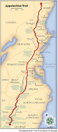
Welcome to my trail blog for my 2009 Appalachian Trail Hike! Here you can find all of my journal entries of my 2178.3 mile journey from Springer Mountain in Georgia to Mt. Katahdin in Maine. You can see my picture slideshow to the right, as well as a recap of my hike mile by mile and gear list. Download the ebook about my hike on iTunes. I hope you find my quest inspiring. Thanks for visiting and Happy Trails!
Subscribe to:
Post Comments (Atom)


No comments:
Post a Comment