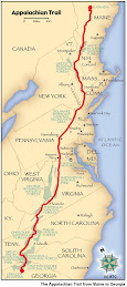
Welcome to my trail blog for my 2009 Appalachian Trail Hike! Here you can find all of my journal entries of my 2178.3 mile journey from Springer Mountain in Georgia to Mt. Katahdin in Maine. You can see my picture slideshow to the right, as well as a recap of my hike mile by mile and gear list. Download the ebook about my hike on iTunes. I hope you find my quest inspiring. Thanks for visiting and Happy Trails!

Thursday, February 26, 2009

Neels Gap to Dicks Creek Gap 2/24/2009-2/26/2009

Pictures: http://outdoors.webshots.com/photo/2314640220104728652CpplsO

2/24/2009 6:30 PM - Low Gap Shelter - 10.8 mi today - 41.5 mi total

Tough day! I really felt every mile. Woke up at seven. Pirate was walking around mumbling something and taking pictures of everyone for the wall. Probably got a great shot of my morning face. Had a Pop-tart and bagel with honey for breakfast. Must buy honey at the next stop as it goes well with a lot of foods and has a lot of calories. After breakfast, I started packing my stuff and helped Gentle Ben set up his tent. He hadn't done it yet, so we showed him how. He's a really nice guy, but he seems a bit timid about headin into the wilderness. He bought all of his gear there and has been hanging around for a number of days. It didn't look like he would be leaving today, though he said he intended to. After packing I went to the store to buy some food. Only had to get two dinners and a Pop-tart as I still had a lot of food left over from the last leg of the journey. Also bought fuel and a lighter and I picked up a nice rain cover for my pack from one of the "hiker boxes" which is gear left behind by people for someone else to use. Mike got the "shakedown" and I stuck around to see part of that. Left Neels Gap at 10:30 solo. Went pretty slow to start. Had lunch at 12:30 on Wolf Laurel Top. Mike caught up just as I was finishing. We hiked together easily until 3:00, but were still 4.4 miles short of where we wanted to be. We kicked up the pace leaving Hogpen Gap and made it to Low Gap Shelter in an one hour 45 minutes. Lone Wolf and Jeff, a section-hiker, were already here. Pumped water and got dinner going (Switchback Spaghetti). Stove is not going to last. After dinner, I hung my bear bag and looked at the map. Lone Wolf and Jeff got a fire going and it feels really nice now. Dustin just arrived. He was walking with his headlamp. Great way to end the day. Shouldn't be too cold tonight either. I think I'm developing a Southern drawl. Mike sez all ya have to do's slur your words togethabit.

2/25/2009 7:00 PM - Tray Mountain Shelter - 15.0 mi today - 56.5 mi total

Long day! Went to bed last night kind of late as the fire kept me toasty. Woke up this morning after a long night. As I was falling asleep, I could hear a couple of mice scurrying around and squeeking a bit. I woke up at one point to feel one crawling over my feet. I kicked him away and sat for ten minutes trying to figure out why I seemed to be getting the attention as the other four people in the shelter slept soundly. I suddenly realized I had left a bag of GORP in the side pocket of my bag! I uickly grabbed it and threw it to the bottom of my sleeping bag. Upon further inspection in the morning, I found two little chew holes at the corner of the GORP bag and some droppings in my boots. Gross! I had Pop-tarts and apple leathers for breakfast and hit the trail with Mike at 8:30. We started on a gradual uphill and were amazed to find that we had covered 5 miles in under two hours. We took a short snack break and hiked to Blue Mountain Shelter for lunch at 11:30. We left at 12:00 and made it to Unicoi Gap by 1:00 for another snack break. My legs were feeling good and we decided to shoot for Tray Mountain Shelter. While in the parking lot, I saw some mice in the leaves. Aparently word had already spread that I was the bearer of GORP. From the road it was 1,000 feet up to the top of Rocky Mountain. This was the first straight 1,000 foot climb so we rewarded ourselves with a Jolly Rancher each. We moved past the summit at 2:00 and it was a long hard four miles from there to the shelter. My feet were definitely feeling the pounding. I popped a couple "vitamin I" for the last 2 miles. We pulled into camp at 4:30 after summitting Tray Mountain, which is only 20 feet shorter than Blood Mountain. Wes, who had also stayed at Hawk Mountain Shelter the first night, was already there. I made White Mountain Stew for dinner and might have figured out my stove problem. I'm going to play around with the potstand tomorrow and see what I can adjust. I hung my bear bag and it started to sprnkle as we built a fire. It was nothing compared to the blaze we had last night, but it warmed my toes nicely. We chatted with Wes for a bit and a section hiker with his dog "Butters" arrived. He was friendly, but had no control of the dog. I hope that Harley enjoys it out here. It might rain tomorro. We are going to try to make it to Hiawassee and stay at Blueberry Patch tomorrow night. In the mean time, my GORP is safely stored in my bear bag.

2/26/09 10:20 pm—Dicks Creek Gap—11.0 mi today—67.5 mi total

Slept pretty well last night. I didn’t hear any mice which was a relief, though apparently they were chewing on Wes’ glove a bit. They must have been going for the salt. I had chocolate granola with dried blueberries and dehydrated milk for breakfast that was good. It was really foggy when we woke up and it look like it had rained overnight. Everything was damp from the humidity. We packed up and made tracks at 9 am. Started with a pretty easy pace and covered 4.8 mi in the first two hours. It always feel good to put away miles early in the day. I had to play around with my layering system a bit to get it where I wanted. Eventually I got down to just shorts and a shirt. The toughest climb was Kelly Knob just shy of 1000 ft. We took a nice long break at the top and applied some Gold Bond cream to stop the chaffing. We were walking in and out of mist all day, and I got some cool photos of the trail. From Kelly Knob it was mainly down hill to Dicks Creek Gap, although there were one or two PUDs (pointless up and down) along the way. The down hills are tough on the knees and the feet. At the beginning of my hike I was flying on the down hills, but now I am taking my time to prevent injury. We got to Dick’s Creek Gap by 2:15 and we skipped lunch as we knew there was AYCE (all you can eat) in Hiawassee. We called Blueberry patch hostel and Gary came to pick us up. He thru hiked in 1991 and converted his garage into a hostel after his hike. It is a great place. He has bunks for 8 with a hot shower, fridge full of coke and hot breakfast tomorrow morning. When we arrived we meet two other thru hikers, Jeff and Dan. After claiming bunks and handing over our dirty laundry, he gave us the keys to the Jeep and told us to head into town. Our first stop was China Grill Buffet. For 9 bucks a piece we got all the Chinese food we could take and free refills of soda. I had two fully loaded plates and left stuffed and happy. The next stop was the library to update my blog and check the email. Thanks everyone for the support and emails. Keep them coming, I love to read them. While I was in the library I caught a look of myself in the mirror—I look like a bum! We finished our of Hiawassee with a trip to Ingles Grocery Store. I spent 58 bucks on 4 days of food. I am pretty sure I over bought. My appetite hasn’t increased that much, but I am sure it will soon. When we got back to the hostel we drew numbers for the first shower. I got last, so I took the opportunity to break down my food and call home. It looks like the new stove is going to make the first shipment, which is great. I am also hoping to cut weight from the maps by just copying the elevation profiles and leaving the rest behind. It may not sound like much, but it adds up. Shower felt great, love that clean feeling. The rest of the night was spent chatting with the other guys, comparing gear and preparing for the next day on the trail. This is now officially my longest backpacking trip as we topped 50 miles yesterday. Tomorrow we should hit another milestone as we will hopefully cross from GA to NC. Unfortunately the weather doesn’t look good the next two days, rain is forecast. I can’t complain too much though, because we have been very lucky to this point. I am also pretty psyched to have scored a pair of Superfeet insoles from the hiker box. They are supposed to make a big difference. We’ll see. I am keeping my old insoles just incase. Also, I am going to keep a log of interesting people I meet on the trail. So far the list consists of Booger (farting talkative marine), Lone Wolf, Pirate, and Dartman—lets hope there are many more. I also hope to post some picture to my Webshots account as soon as I get my camera cable. Check back soon!

Monday, February 23, 2009

Springer Mountain to Neels Gap 2/21/09-2/23/09

Pictures: http://outdoors.webshots.com/photo/2992579620104728652pBZTSW

2/21/09 1:20 pm—Springer Mt—0 mi today—0 mi total

Just summited Springer with Mom, Dad and Harley. Sitting next to first White blaze! Beautiful weather—here’s to adventure!

2/21/09 7:00 pm – Hawk Mt. Shelter—7.5 mi today—7.8 mi total

Great first day! Camping in the shelter with about 8 others. Left Mom and Dad at 2:30 in parking lot. Hiked 6.8 solid miles in 3 hours. Good pace, got to shelter with enough time to cook dinner: chili con carne. It was excellent! Stove worked well, going to bed now.

2/22/09 7:10 pm – Woody Gap – 12.3 mi today – 20.1 mi total

Great day! Woke up to 2 in of snow. Slept well except for a space blanket next to me, the man next to me sounded like a plastic bag all night long. Went to bed at 9 last night, stayed up late talking with Mike and Dustin. Both cool guys, from Colorado and Mississippi. Cooked up oatmeal in the morning. Stove needs work, it is hard to get primed. I should have attached a wick. Matchbox that I brought is really crappy, it shredded when I tried to strike a match. Dustin let me borrow his lighter. Pumped water from spring. Love the pump I brought, it is fast and easy. I got all my stuff packed up and was fourth to leave, although I was the last out of bed. The talkative farting Marine went first, then Wess, then Mike, and then there was me. Dustin looked about 5 minutes from leaving when I took off, although I didn’t see him all day. Good pace in morning, hiked fast to stay warm. Lots of snow and cold wind on the trail. I wore just long underwear, pants, shirt and bandana, although I probably should have worn gloves. I took a picture at Horse Gap as I broke double digits (10 miles)!! I had chicken salad and crackers for a snack on Justus Mt.. At 12 I met Mike finishing his lunch as Justus Creek. Made 2 mi/hr at this point. I had a quick lunch and followed the back trail. I passed Gooch Mt. Shelter quickly towards Gooch Gap. I caught up with Mike there as well. We hiked together to Woody Gap. We have a similar pace, the last couple of miles my legs were not happy L We got to Woody Gap at 3:30 pm, just shy of 2 mph for the day. Windy!! Set up tents, but then we found a better spot so we moved our tents 30 yards. Pumped water from spring. I accidentally left my poles behind but Mike brought them back. I cooked chicken and nuts stir pot for dinner. I need to upgrade stove and fuel bottle. I hung a bear bag but left my breakfast in the tent. I hope I don’t get eaten by a bear!! I hope to get to Neels Gap by tomorrow afternoon. It is 10.6 mi from here. Blood Mt. (highest point on AT in GA is in the way). Hoping it doesn’t snow again. My 2-person tent is nice and roomy without Harley, although I would rather have him here with me.

2/23/09—6:10 pm—Neels Gap—10.6 mi today—30.7 mi total

Woke up to FRIGID temperature! Some guy in a car said it was 16 degrees!! With wind it felt really cold. I ate my cream of wheat and Carnation instant breakfast…cold. It tasted pretty good. I almost got frostbite trying to clean the dishes. Definitely not worth it. I warmed up at the privy. I packed up and left at 9 am with Mike. It was a beautiful view from first mountain, Big Cedar Mt. I took some pictures and got some solid miles in. Took a snack break at Henry Gap (4 miles and 2 hrs). My water hose was frozen until this point. I must remember to blow it clear every night. I reached Jarrard Gap at noon. I ran out of water, but was not going to walk .3 mi down a hill to get it. I continued to Slaughter Creek. I arrived at 12:50 and pumped water. I attacked Blood Mt. and summited at 1:30 (highest point on the AT in GA). Here I took an hour for lunch and had some gouda cheese and a Nutrigrain bar. I met 3 guys, who were trying to meet up with 3 other guys…they all had matching backpacks. They were nice, but they had no clue how to read a map. I came down Blood Mt. (steep and rocky). Got to Mt. Crossings (a store) at Neels Gap around 3:30. I took some pictures outside. The store is really cool! Everyone is very friendly. I paid for a night in the hostel (16$) and washing load ($3). I met Ben, a nice guy attempting a thru hike. After I showered I ate dinner with others in hostel. Pirate cooked beans and pork with cornmeal for everyone. It was really good! I watched a bit of an old western about Sam Houston (there was a small VCR at the hostel). Dustin arrived after dinner. It turns out he was at Woody Gap last night too. I can’t believe we missed him this morning. After dinner I called home. It was nice to hear familiar voices. Ben cooked 2 frozen pizzas to share and Cool Breeze passed around a PBR (beer). This is a really friendly group. I am planning on taking stock of food tonight before bed, and making purchases tomorrow. Mom says the SPOT is working well. I hope everyone is having fun at home following along.

Friday, February 20, 2009

Springer in the morning

After a long two-day drive, we finally made it to Amicalola Falls State park at 6:00 this evening. Of course we forgot to check the weather forecast before we left Rochester, so we drove through a blizzard as we made our way from Buffalo to Cleveland. It was whiteout conditions at some points and we saw a bunch of cars that had skidded off the road, including an 18 wheeler at one point. I was white knuckle driving. We made it to Cincinnati on Thursday night and hit the road this morning at 9. I had a lot of time to think and I'm pretty sure the only thing I forgot was a sponge to clean my cook pot after every meal. I was just going to suck it up and use my bandana, but Mom found one at a gas station.

The drive also let me get mentally prepared for the trail and come up with a list of goals. I think it's an important part of the preparation and will help me to guage my progress in a unit other than miles. Here is the list in order:
1. Have fun
2. Hike my own hike
3. Find myself
4. Seek out adventure
5. Summit Mt Katahdin
I hope that by reminding myself of these goals it will help me to enjoy myself but also push myself and get outside my comfort zone so that I can grow as a person.

When we did finally arrive at Amicalola Falls State Park, the visitor center was closed so I had to register outside in the binder. There was only one other entry on the thru-hiker page, a guy who left on February 9th carrying a 60 pound pack! I had my official weigh in before I left Rochester and my pack weighs around 20 pounds without food and water. When I hit the trail tomorrow, I will be carrying 6 pounds of food and about 4 pounds of water. I am very happy with that number considering the fact that when I did my 50 miler hike in 7th grade with the Boy Scouts, I was carrying a 35 pound pack! I am 9 years older, at least 60 pounds heavier, and a couple inches taller then I was back then. This should be a piece of cake! [insert weak chuckle here] I currently tip the scales at 185 pounds. I wonder how much I will lose on the trip. I know that I will definitely lose the donut I have been carrying around since freshman year.

After registering as a thru-hiker, we walked around the visitor center and found a cool plaque and "the portal" as I like to call it which marks the beginning of the Approach Trail to the top of Springer Mountain. I will not be hiking the Approach Trail as it is an extra 8 mile path that leads to the top of Springer and is not considered part of the Appalachian Trail proper (it's not part of the 2178.3 miles). Instead, tomorrow morning we will drive around Springer to the northern side using Forest Service roads and park one mile down the AT from the summit. From there we will backtrack to the top of Springer Mountain, take a load of pictures, sign the register, take a look at the shelter that is at the top, and then hike back to the parking lot. Then it is time for good-byes. Mom and Dad will head to Charlotte to visit some old family friends and I will head North to Katahdin. My goal is to hike at least the first 7.8 miles to Gooch Mountain Shelter. Beyond that, I will likely depart from the schedule I wrote out. 

It is still hard for me to believe that I start hiking tomorrow. It is hard to put the whole scope of this trip into perspective. If everything goes well, I will be hiking almost every day for the next six months. That is just RIDONCULOUS!!! I just hope that it is an adventure that I can look back on fondly when I am an old man.  I doubt that I will sleep much tonight. I am too excited to get out there!!

Tomorrow morning I will shave for the last time until August (that is if my girlfriend lets me get away with graduation pictures with a beard). As for now, I am gonna try and get some sleep so I am ready for my big day tomorrow. Here is to adventure!

p.s. - I added some sweet pictures of the trail head to my webshots, check them out!!

Thursday, February 19, 2009

We're off!

The car is packed, I'm shutting off my computer for six months, it's time to go! Here's to adventure.

Hit the road

I am finally ready to go. I just videoed myself packing my backpack so I know exactly what I started with. I am sure it is a really boring video because I am dead tired, but I'll post it to youtube anyways. It will be interesting to see what equipment I shed along the way. I feel like I have eliminated everything unnecessary, but I may find at some point that I don't need a specific article for some reason or another. I am also looking forward to seeing how the food works out. Mom and I have spent hours reading recipes, putting shopping lists together, walking around Wegmans discussing options, measuring quantities, and filling up Ziploc bags. We have the first 850 miles covered. Mom has agreed to finish doing all the food prep while I am hiking which I really appreciate. I just hope that I have stuck the magic balance between weight and calories. They say you should carry no more than 2 pounds of food per day on the trail. My first set of rations was right on. I am sure I will learn a lot as I hike.
So the plan for Thursday is wake up, load the car, review the food drop plan with Mom and Dad, and hit the road. We will take two days to drive down to Springer Mountain. I'll hit the trail on Saturday morning.

Wednesday, February 18, 2009

One day to go...

Wow I can't believe that I only have one more day to finalize everything. I will get it all done, but there are so many loose ends I need to tie up tomorrow, in addition to completing my last pre-hike workout with Mom at the Y. The past few days have been a blur. I had a great weekend up in Maine visiting Rachel and all of her roommates. On the way home, I stopped by Skidmore to visit my friend from high school Derek. He drew me the most complicated map ever showing how to get to I-90, but it worked! I was also able to try out my SPOT satellite messenger which I will be carrying on the hike.

Since getting back to Rochester, I have been packaging up food like crazy. Mom and I put together about 35 dinners tonight. We are using some recipes from a couple of books that I got for Christmas, but towards the end, we were just throwing ingredients together and making it up. It's more fun that way. It's a time consuming process. I also tried out one of the recipes tonight using my backpacking kitchen. It worked pretty well, though the food was a bit bland. Because of that, Mom and I were adding spices and flavoring to each entree. Tomorrow, I need to go shopping so I can put some more dinners together and then get everything boxed up. I have all the food planned and packaged up to Shenandoah National Park (850 miles down, 1328 to go).

So thats the news for now. Thanks everyone for all the supportive emails and facebook messages I have been getting. Hopefully this blog will be a tool for reflection for me and a source of inspiration for you.

Thursday, February 12, 2009

Trip to Maine

I just activated my SPOT Satellite Messenger in time for my trip to Bowdoin College to visit Rachel. I will be carrying this with me on my hike, so the car journey up was a good opportunity to test it. You can now see where I am by clicking on the map on the toolbar at the right. It will show a seven day history, so when I start my hike next weekend, you will be able to see my weekly progress.

Thats all the news for now. My mom and I have been working really hard to get the mail drops planned over the past couple days. When I get home from Maine, I will be making the final preparations before heading to Georgia on Thursday. Look for more updates early next week.

Wednesday, February 4, 2009

Change of plan

My parents and I decided that it would be best if I started the trip without Harley until I am north of the Smokies. It makes a lot of sense. This means I get to hike the entire trail (instead of simply skipping the Smokies like I had planned before. It also allows me to adjust to trail life on my own without having to worry about the dog. The only thing that worries me is that I will lose the connection I have with him during the three weeks I am away from him. Since I returned home from college, we have spent a lot of time together and we have grown used to having each other around. He gets quite upset when I leave the house to run errands as he sits by the door waiting for my return. I guess that is what we have to deal with. There are only three sections of the AT that don't allow dogs: the Smokies, a one mile stretch in New York where the trail passes through a zoo, and the finish in Baxter State Park in Maine. The zoo in New York has another trail that circumvents the stretch, and now thanks to my parents, I have the other two areas sorted out as well. Dad is going to drive him down on March 14. This also means that the first three weeks of my schedule are set in stone. I don't have to follow my plan exactly, but I do have to cover about 235 miles in three weeks. Hopefully I am up for the test. I have updated my itinerary to reflect the changes.

Tuesday, February 3, 2009

Less than three weeks!

Sunday was the first of February, meaning that I leave in less than three weeks! I have so much to do before I leave (plan the menus and package up the food drops), but I know that these couple weeks will fly by and soon I will be on the trail.

Harley's new pack came last Friday. It is definitely an upgrade over the previous model. Originally I bought a Kelty Chuckwagon from REI, but after a couple test hikes, a hole developed where the leash attaches to it because he had been pulling so hard. Luckily REI has a GREAT return policy and gave me a full refund no questions asked. Instead I bought the Ruff Wear Pallisades II pack from geartrade.com for cheaper than the Kelty. It had a broken clip, so they had to sell it at a significant discount. After replacing the clip which cost me one dollar, I had a brand new pack for $35! It seems to fit him better as well and I really like the fact that the bag can be detached from the harness. Hopefully we will get out to Mendon Ponds Park on Thursday for a hike.

Apart from that, I am working hard with mom to come up with the menu plan. I have all of the mail drops planned out, now we just need to package them up with enough food. I'll post the mail drop schedule for all to see. I think that the hardest part is going to be rationing out the food because I have no idea how much food will sustain me on the trail. I know that I will want to eat like crazy because I will be burning 4000+ calories a day. We have the dehydrator going non-stop.